Monday, April 14, 2008

On the road again.... (I wish)

Well, we're not on the road yet, but I'm definitely itching to see the Tacoma area in my rearview mirror. Team Hikenutty absolutely LOVES road trips of all lengths, which makes us a big fan of the highway categories. So far the Website has categories for the Mother Road (US66), the National Road (US40), the Dixie Highway, the Pacific Highway (US99) and for Lincoln Highway Markers. I WANT MORE!!!

You'd think that those five would be enough, but recently I bought a couple of books that have me thinking of other great highways that could use a category.

First, I think that the Lincoln Highway could use a second category that is wider reaching. Currently only highway markers can be waymarked along that route, but last summer while traveling along the Lincoln we saw some awesome spots. Old service stations, vintage motels, roadhouses that have been open since the 1920's, road camps, and more. These places deserve their own category! I'm fine with the current category keeping its focus on the roadside markers, but I think there is some great Americana along the route that should be grouped together in its own category.


(L) Muffler Man in North Platte, NE; (R) Old Lincoln Hwy. motel in Cheyenne, WY


One more category and we should have the major east/west highways covered. We have the center of the country covered, but what about up north? Highway 2, dubbed the Great Northern, is the longest of all of the great transcontinental road trips in the U.S. and also the most stunning of the east/west passages. It takes you over the Cascade Mountain Range and past the Grand Coulee Dam in Washington, over the Rocky's and through Glacier National Park, the North Woods of Minnesota, Michigan's Upper Peninsula, into Canada, over Vermont's Green Mountains, through New Hampshire's White Mountains and ends up in Maine's beautiful Acadia National Park. Along the way you'll experience gorgeous spots and plenty of vintage Americana. I've never really travelled this route however I have been to Grand Coulee Dam country and here are a couple photos of that area.


(L)Banks Lake, a Grand Coulee reservoir, seen from atop Steamboat Rock; (R) Steamboat Rock


Now that we have the east/west covered, I'll move on to the north/south corridors. So far the only full, cross-country north/south route that has a category is the Pacific Highway, US 99, which confusingly doesn't get near the Pacific Ocean. I propose four more - yep four - north/south routes that are all truly exquisite road trips.

First (and nearest and dearest to my heart) is the Pacific Coast Highway, US101. This is completely different than US99 (which is full of Americana, but very light on scenery). Many consider it to be the most beautiful long distance road trip you can take in the U.S. and I would definitely agree with them. Sorry to all of you easterners out there but there isn't much that can beat US101's views of the Pacific. You'll start up north in one of my favorite stomping grounds, Olympic National Park and from there you'll head south, hugging the coast. See the beautiful Hoh Rainforest in Washington, the many peaceful, pristine beaches of Oregon, Redwood National Park and Big Sur in California. And as many of you know, kitsch can only reach its full potential in beach towns for some reason. Maybe it's the salty air. I've travelled 101 from it's beginning in Olympic National Park down to San Francisco and the roadside attractions just can't be beat. These places should be gathered together in a Coast Highway category and I'd be willing to lead it if anyone is interested.


(L) Redwood National Park; (R) "Hole in the Wall" in Olympic National Park


Now I'll move across the country to the Atlantic Coast to U.S. 1, the "Colonial Coast Highway". It dates from 1926 and originally ran from Fort Kent, Maine all the way down to Florida's Key West. This summer I'll see the Atlantic for the first time (other than flying over it in a plane) and will have the chance to drive along a small portion of this road. It travels through some of the Nation's first and greatest cities and nowhere else will you get such a taste of history while you're on the road.

Moving back across the country to the wild west we'll hit the next great highway that should be waymarked - U.S. 93. Jamie Jensen, in his book "Road Trip USA: Cross-Country Adventures on America's Two-Lane Highways", calls it the "Border to Border" road trip but in fact it starts far north of the Canadian border (also numbered as highway 93) up in beautiful Jasper National Park. This trip is an exercise in extremes. The first half is spent in the Canadian and U.S. Rockies, and the second half in the Southwest's desert region. There you'll drop into Las Vegas, cross the Hoover Dam, cross route 66 west of the Grand Canyon and then head into the lush Sonoran Desert. Lots to see and do and above all else, WAYMARK! I'd show you a few photos of the southern portion of this route, but alas, they were taken before I owned a digital camera.

And last but not least, the Great River Road, which follows the mighty Mississippi from its headwaters in Minnesota to its mouth at the Gulf of Mexico in New Orleans. We spent a day travelling along the river road last summer and it was quite enjoyable. I would love to spend some time along the northern portion of the road some day. I hear that Minnesota's portion of the road is incredible. There have to be a few folks in the Midwest who'd be interested in starting this one up.


(L) Mississippi River overlook in Davenport, IA; (R) Riverboat Paddlewheel


So there you have it. Six new, amazing categories just waiting to be created. I think the two coastal highways should be first. Any takers?

Thursday, April 10, 2008

Category Dictatorships

It has always been a pet peeve of mine when category creators view a category as something "owned" by them. These category dictators see group officers as people to share the work load, but nothing else. In their opinion, they thought up the initial idea and could care less what anyone else's opinion is. I don't see it that way. They are leaders, not owners, and by refusing to listen to officer's suggestions they limit the category.

Close-mindedness leads to categories that become stagnant. If there needs to be some tweaking of the category it helps to have open communication, as I talked about in my last post. Without this communication and tweaking to waymarkers become frustrated and don't continue to submit to the category. Unless I am extremely interested in a subject I won't submit more than one waymark to a category that is unclear as to what type of waymarks they're looking for, or to a category where the officers are rude when they make comments. There are plenty of other categories out there to take up my time. I kick it to my ignore list and move on.

Another issue I have come across as an officer is when leaders go through and re-evaluate waymarks that have already been approved. Nothing is more irritating as a waymarker than to have a waymark approved and then denied. If an officer is regularly approving things that the leader doesn't think fit, then the leader isn't doing their job very well. It indicates that either the category needs to have a few changes or the group needs to sit back and discuss reviewing practices and what is and isn't acceptable. Just re-evaluating an officer's approved waymarks and not politely discussing the problems is micro-managing. It treats the symptoms and not the main issue.

I'm not saying that the leader's vision for the category means nothing, I'm saying it doesn't mean everything. We all share the Waymarking Website and a single person cannot own one section of it. A category is created to share places with the world and a leader is only the category's guide, not its god.

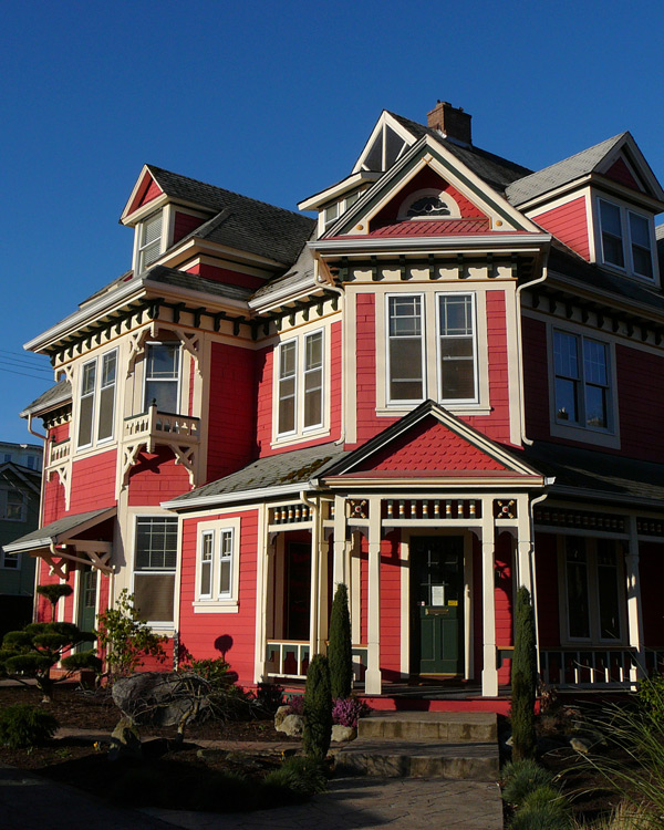
This has been your latest installment of Janell's Pet Peeves. For more, just ask me about chain store categories. (kidding :) The photo above really has nothing to do with this post. The Victorian triplex is posted in the "NRHP - Contributing Buildings" category which is led by a person I've found to be a great collaborative leader, JimmyEv. So I guess that it has a tiny bit of context.

Monday, April 7, 2008

Great groups have great communication

Something that I've noticed lately: the better the communication, the better the category. When a category is approved and the officers start reviewing waymarks they soon find that maybe the category definition or requirements aren't as clear as they expected they would be. That's okay, because if a leader and the officers are doing their job they will talk about issues that are raised and adjust things accordingly. No category is perfect and even the most well written and thought out descriptions might need some tweaking over time.

Discussion, disagreement, even debate, is necessary - in some categories more than others. Next time, before you hit that "vote" button when reviewing a questionable waymark, consider sending out a group email and asking the group about it first. Often there are underlying reasons that things are going to vote - something unclear in the category description that could be fixed. Why not talk it over and see if there's a way to make things clearer. It will save you work in the long run by limiting the posting of waymarks that don't fit the category. It will definitely make people who post to your category happier, because no one likes to put the work into posting a waymark and then have it declined.

If officers in the group don't have the "email group member" ability then be sure to email the group leader and see if they will change this. If you are the group leader, then what are you waiting for?! Go make the changes so your officers can better participate in discussions. I assure you that your category will benefit from the change. There really isn't a reason not to do this. In fact, I wish that it was an automatic feature for officers. Maybe make it automatic, but allow the leader to take back the privilege if an officer is abusing it.

Anyhow, just my 2 cents. Happy waymarking!

Tuesday, April 1, 2008

How small is too small?

Recently I was voting in peer review for something and at the time thought that the available waymarks might be too small in number for the category to be viable. So how small is too small? I can't remember the exact voting criteria, but I know that one of them is "abundance". I've always thought that could go either way - there are so many possible waymarks that there's really no reason to waymark them (my beef with most fast food categories) OR there are so few that they will be too difficult for people to find.
When I think about it though, if something is interesting with maybe a bit of historic importance thrown in, doesn't that make it exactly the type of place to be waymarked so others can find the spot in the future? If there are only 50 possible spots worldwide, wouldn't it be great to create a place where interested folks could find all 50?

Here's another thought. What if the 50 spots aren't worldwide, but they are all in one small area? Would it meet criteria then?

There really is no exact answer. Drawing the line somewhere would be foolish because there are too many factors involved. This is yet another example where being too rigid will limit the Waymarking Website. Better to embrace the fuzziness of the criteria in this case than to create some silly line in the sand.

So here's a confession though. When voting, I admit that my willingness to vote "yea" for a category is definitely affected by how interesting the category is to me. Try as I might to be objective, there are times when I just can't swallow a category and I might invoke the "too many/too few" criteria. I try not to do that very often, but sometimes it happens and I know I'm not the only one who does this so don't get all "holier-than-thou" on me. I'm not saying it's good practice, just that it happens.

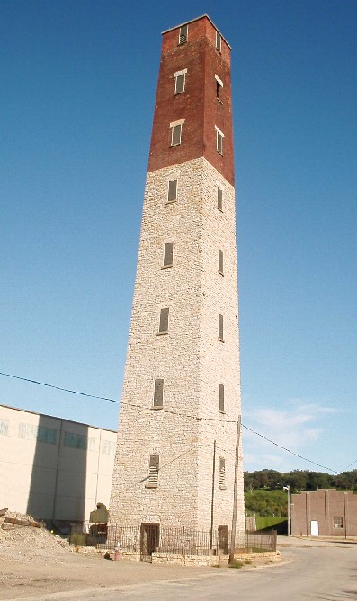
Just thinking as I type here, so sorry if this post is difficult to follow. If you do understand what I'm talking about, let's hear how you feel. Oh, and the photo above is 8Nuts MotherGoose's photo of the Dubuque Shot Tower which we visited last summer. "Shot Towers" is one of those categories were the total possible waymarks are very limited, however, it still seems like a worthwhile category.

Friday, March 28, 2008

Car-marking

I've noticed recently that several of the category descriptions say something about waymarks with "photos taken from car windows will be denied." Well, I'm here to tell you that most commercial waymarks that I post have photos taken from car windows. Who cares?! Now, I realize that you don't want a photo with an antenna running through it or part of the car door in the shot, but if it's a business, it's not like we are photographing a breathtaking or even interesting subject that needs extra care taken with the angle of the shot. Why would I get out of the car to photograph a cigar store, or a Burger King, or a Pizza Hut? I'm not going inside the places, for God's sake!

Now I know that some of you are saying, "but you have to get out of the car anyhow to get the coordinates at the door." Actually, no, I don't really. For the sake of the category officers I will try to get as close to the door as possible, but again, puleeeeeease, what is with this requirement?! If I take the coordinates from the first row of the parking lot, 15 feet from the entrance, is some poor waymark visitor that's going to show up, find the coordinates, and then say, "damn it! There's no McDonalds at this spot! Where the hell is the McDonalds?!" No, they will know where the McDonalds is from a mile down the road. That's what thirty foot golden arches are for.

Sometimes, it is important to be absolutely exact with your coordinates - a benchmark, a historic marker, a Toynbee tile.... But a restaurant or other business establishment is not a tiny, difficult to locate spot. If you can get a person within 20 feet of the door, unless they're an idiot they should manage to look up and notice the business. An exception to this rule might be a business inside a mall - then it would be important to get coordinates at the closest mall entrance, not from the far reaches of the parking lot. But that's the thing, people. There are always exceptions. Being rigid will just cause your category to lose some perfectly good waymarks. Is a waymark really less worthy of your category because the coordinates are 15 feet from the door? In my opinion, no.

So before you hit that deny button, take a deep breath, count to ten, and then ask yourself "is this really worth turning down a perfectly good waymark?" My guess is that 9 times out of 10 the answer will be (should be) no.

I'm sure that some of you are wondering if a denial spurred this diatribe. Nope. I have never had a waymark declined because the information and photos were taken from my car. It's just that most of the ultra rigid requirements, IMO, are detrimental to the hobby and really turn new people off from continuing to waymark. This is just the most recent of the many rigid requirements that I happened to come across right before writing this blog post.

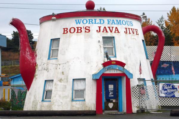
Oh, BTW, the photo above is of "Bob's World Famous Java Jive", a US Route 99 Americana landmark in south Tacoma, and YES, I took this photo through my car window.

Monday, March 24, 2008

Bingo!

Assuming that my weather station waymark that I just submitted yesterday is approved, I finally got around to finishing off my 2nd bingo on the waymarking grid. Since weather stations aren't especially exciting, I thought I'd post some photos of favorite waymarks from this row of the grid.


Oregon Trail - Independence Rock in the "Wagon Roads and Trails" category - Many emmigrants left home in the spring, hoping to make it to Independence Rock by July 4th, hence the rock's name. Names of the many travellers are inscribed on the rock.


Left - Pick-Quick Drive In - Fife, WA in "Independent Diners"; I highly recommend a stop here if you're in the area. It's extremely popular, so you may wait awhile, but if you love drive-in food (burgers, onion rings, hand-scooped milkshakes in about 40 flavors) you'll love Pick Quick.
Right - Sears Tower in "Engineering Landmarks"; From 1974 to 1996 the building remained the tallest in the world at 1,730 feet.


Henry M. Jackson Visitor Center - Mt. Rainier National Park in "Googie Architecture"; I have several favorites waymarked here and although the Space Needle is a googie icon, I went with my favorite, the soon to be demolished Jackson Visitor Center in the Paradise area of Mt. Rainier NP.


Art of Chicago in the "Waytours" category; my favorite part of visiting Chicago was the art. Everywhere you turn there seems to be another world class sculputure - Chagall, Picasso, Calder, Moore, Miro - they're just sitting there amidst the skyscrapers waiting for you to find them.


Corina Bakery in "Independent Bakeries"; This little family owned bakery is somewhat hidden with a side entrance in the Merlino Art Center, but don't make the mistake of missing it if you like cake. I love the lemon coconut layer cake and a cup of french-pressed coffee, my husband is nuts for the Red Velvet cake, mother-in-law loves the hummingbird cake and my son is a fan of their super huge lemon bars. Don't miss it! News Tribune Review


So there are some of my favorites from grid row "27". There were some Engineering Landmarks, Googie Architecture, and Waytours that I REALLY wanted to include, but that would have made this long post even longer, so if you have the time check out my waymarks in those categoriers. There are some fun ones. Happy waymarking!

Monday, March 17, 2008

Coal, Fossils and Graves: A reason to visit existing waymarks

I know that most waymarkers live for finding a new spot to waymark, but this weekend I went on a hike specifically to visit one. It was an old ghost town located near the town that I grew up in and I had heard stories about the town and mines of Franklin from my great uncles, both miners. Thanks to the new Franklin waymarks I finally knew where the town was and how to find the trail to get there. We hiked the short muddy 1 1/2 mile trail, knowing that pretty much whatever could be waymarked up there was already posted. Boy would we have missed out on a fun afternoon if we had decided to go off looking for new spots to mark.
The best thing about a ghost town hike is that if you keep your eyes open you will see things that others may have missed - the ruins of old buildings off under 75 years of moss and duff, a coal car trestle amongst the alders, old tangles of cables and rusty pipes, and for us, fossils!

The waymarks we visited where the Franklin Ghost Town, Franklin Mine, and the Franklin Cemetery, all waymarked by Prying Pandora. While at the mine, a covered 1300' deep hole in the ground (covered with grating) that you can drop rocks into, I mentioned to my son how many leaf fossils can be found in coal and the stone in coal mining areas. He gave me the "uh-huh mom" nod as he continued throwing things into the mine. So I wandered over to the sheer rock wall that was behind the mine opening. It was AMAZING! This rock wall, about 8 feet high and 10 feet wide, was covered with leaf and twig fossils. It was like an imprint of the forest floor - millions of years ago. Above you can see one of the photos that I took of it.

Then we hiked on to the abandoned cemetery that some boy scouts and school kids had dug out of the blackberry briars. Daffodils, which had been planted on graves over 75 years before, had naturalized and were blooming everywhere. Bleeding heart was sprouting up and soon their purple flowers would take over when the daffodils finish their show. It was beautiful and touching and so peaceful.

Anyhow, I just wanted to write this and remind you to check and see what other waymarkers in your area (or an area you are traveling to) are out marking. You may just discover a no longer hidden treasure. If you are in the area and decide to visit Franklin a word of caution: the area is riddled with mines and there have been many cave ins in the past, resulting in 1300 feet deep holes. Stay on the trail!

Below are some of the photos from our lovely Sunday hike.


A bolt on an old coal car


Exploring moss covered ruins; a bolt being camouflaged by nature


Another old building's foundation


The mine


A grave at the cemetery


Another grave; Berry blossoms


A coal car trestle near the cemetery